U.S. sea-level report cards: 2022 once again trends toward acceleration

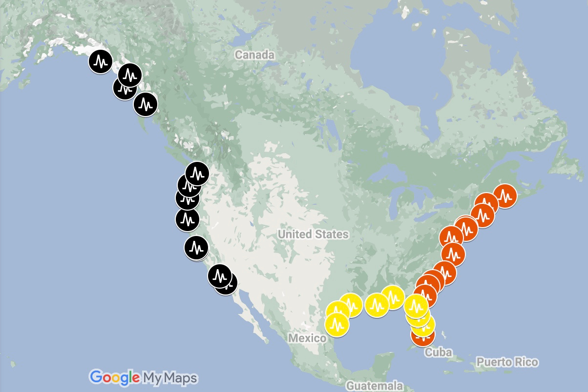
Want to know how sea level in your area is changing due to global warming and other factors? Sea level “report cards” from William & Mary’s Virginia Institute of Marine Science forecast sea level to the year 2050 based on an annual analysis of tide-gauge records for 32 localities along the U.S. coast. The analysis now includes 54 years of water-level observations, from 1969 through 2022. Scroll down to discover this year's highlights and learn why our report cards provide maximum value to coastal residents, businesses, and governments. Then visit our interactive charts, which are available online at www.vims.edu/sealevelreportcards

2022 Highlights

Southeast Acceleration

Upward trends in the rate of sea-level rise along the U.S. Southeast coastline are consistent with the expected pattern from melting Greenland ice sheets. —Dr. Molly Mitchell

SLRC Locations

Localized & Timely

Many sea-level projections are global in scope, with a forecast horizon of 2100. Thus the U.N.'s oft-reported projection of 46 to 74 centimeters (1.5 to 2.4 feet) of absolute sea-level rise by the end of the century. Our report cards add value by providing annual sea-level updates that are localized to 32 U.S. tide-gauge stations and project sea level to 2050—within the lifetime of many mortgages.


Coastal Flooding

Relatively Speaking

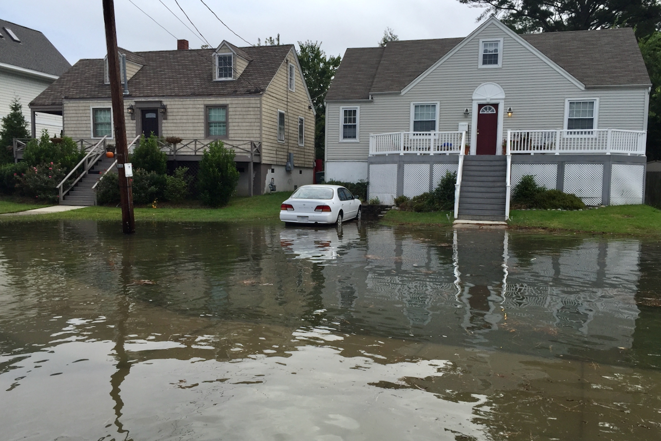
Global climate models predict a rise in absolute sea level—an increase in seawater mass due to melting land ice or an increase in volume due to thermal expansion. Our report cards add value by forecasting changes in relative sea level—the height of water relative to the land surface on which people work and play. In areas like Norfolk, land subsidence due to groundwater withdrawal and other factors magnifies the rise in absolute sea level, compounding the frequency and severity of coastal flooding.

Value Added

"Our approach adds maximum value for coastal residents, businesses, and governments."
—Dr. John Boon, VIMS emeritus professor and project founder

Observed Mean Monthly Sea Level

Built from data

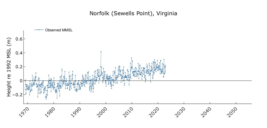
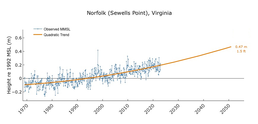
Our report cards are based on an ongoing analysis of the monthly mean sea level (MMSL) as measured by a NOAA tide gauge at 32 localities along the U.S. coast. We correct each value by removing predictable tidal variations. Thus the sharp ups and downs reflect almost entirely non-tidal changes in water level due to storms and shifts in ocean and estuarine circulation.

Linear Sea-Level Projection

Linear Projection

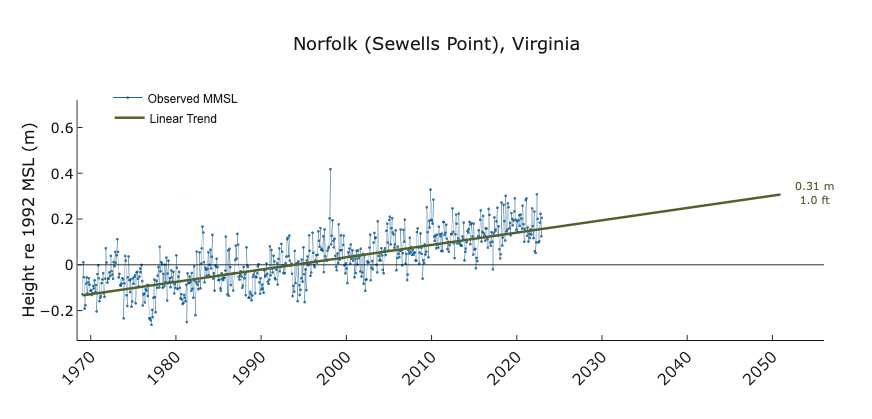
The linear trend indicates how quickly sea level would rise with no acceleration in the rise rate (our analysis suggests this is not the case). We display the linear trend to help clarify that linear projections result in a significantly lower sea level in future years than we expect given recent observations of an accelerating rate of sea-level rise at many stations. At Norfolk, Virginia, the linear trend suggests a 1-ft. rise by 2050.

Quadratic Trend

Acceleration

Our analysis of tide-gauge data indicates that sea level is not only rising at many localities, but that the rate of sea-level rise is getting faster and faster. Projecting that acceleration forward as a quadratic curve results in a significantly higher sea level in future years. In Norfolk, Virginia, the quadratic trend increases our 2050 projection of sea-level rise to 1.5 ft. That's half a foot higher than the linear projection.

Quadratic High

Planning for Extremes

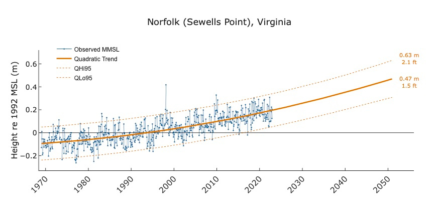
We project that mean sea level in Norfolk will rise 1.5 ft. by 2050. But what planners and property owners really care about are the likely extremes. Shown in dotted orange, these lines encompass 95% of the sea-level observations recorded each month, whether above (QHi95) or below (QLo95) the mean. Extending these lines forward implies that sea level could be of equal magnitude higher or lower than our best (quadratic) estimate of sea level during any future month. The bottom line: the safest planning level for 2050 is a 2.1-ft. rise in sea level—not the 1-ft. rise projected from a linear extrapolation.

W&M Now

Join Dr. Molly Mitchell, co-creator of VIMS' sea-level report cards, as she explains how these forecasting tools can help coastal communities better plan for rising waters.