Data Products
Researchers at the Virginia Institute of Marine Science offer a number of data products—including annual forecasts and real-time monitoring tools—for use by individuals, businesses, and government agencies.
While most of these products focus on Chesapeake Bay and adjacent coastal and watershed areas, a number also provide value to residents of coastal areas nationwide.
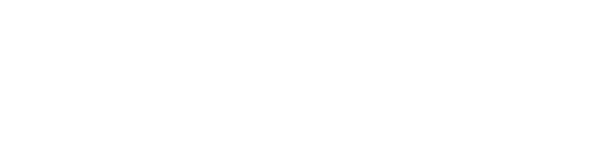
Adapt VA
Evidence-based planning for climate change
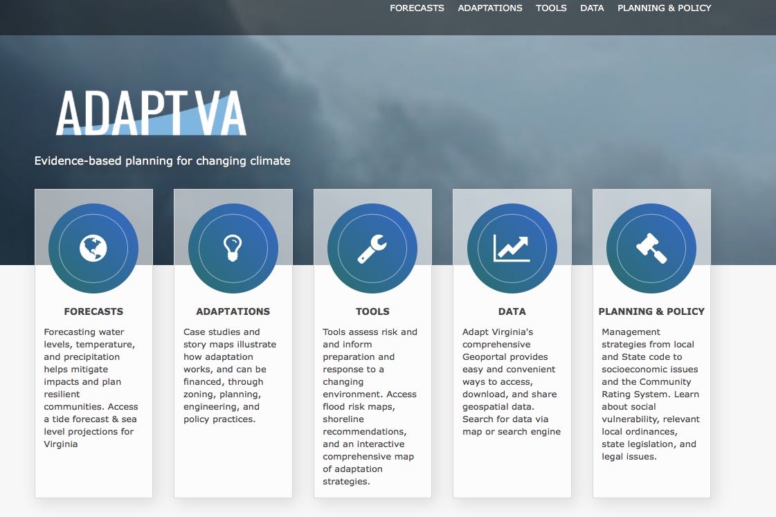
Blue Crab Survey
Winter dredge tracks trends in Bay's blue crab abundance
CBEFS
Consult our Chesapeake Bay Environmental Forecast System.
CCRFR
Statewide expertise to build Virginia's flooding resiliency
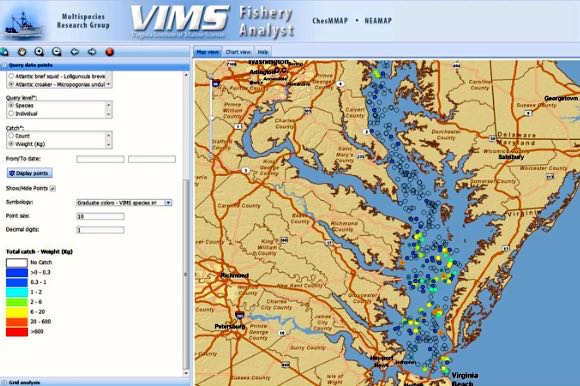
Fishery Analyst
Explore fish distribution & abundance in Chesapeake Bay
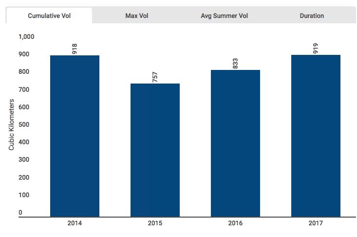
Dead Zones
We forecast low-oxygen conditions for better planning
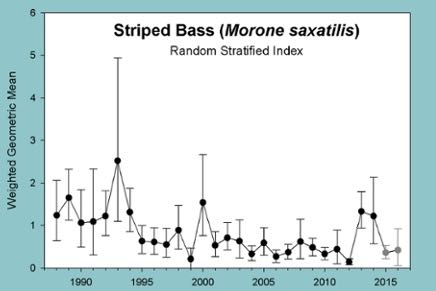
Juvenile Abundance
We count small fish so you can catch big ones
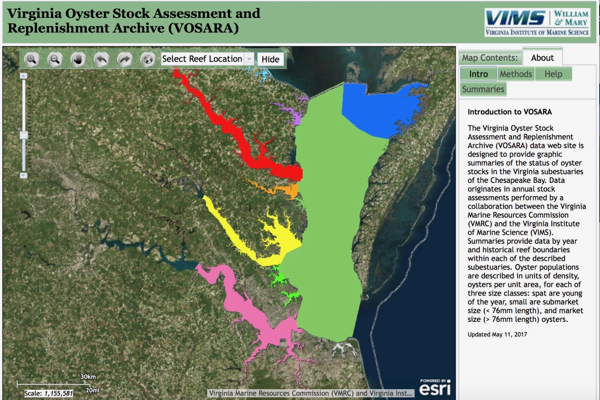
Oyster Stocks
Population data helps guide management & restoration
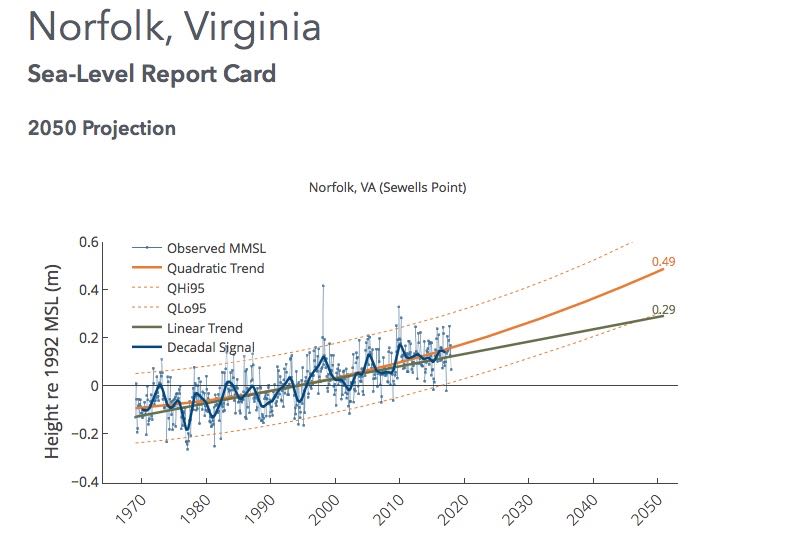
Report Cards
Sea-level trends & projections for coastal planning
Seagrasses (SAV)
Track the abundance & distribution of Bay grasses
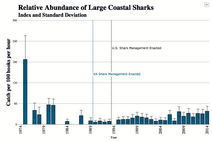
Shark Surveys
Our stock assessments inform fed & state management plans
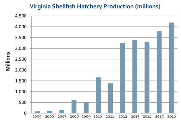
Shellfish Report
Annual survey of oyster & clam farmers highlights trends
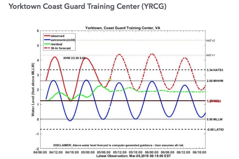
Tidewatch
A better way to plan for storm tides in Chesapeake Bay
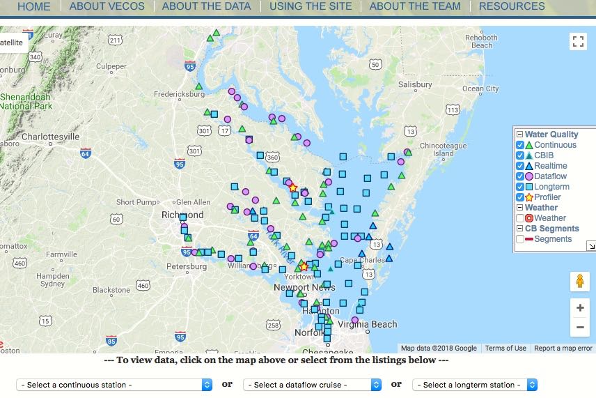
VECOS
Water-quality data for more informed management