WHAT IS FLOODING?
Flooding is an overflowing of water onto land that is normally dry. Depending on the source, the flooding may be predictable, like tidal flooding, or be very unpredictable and vary in frequency, duration and strength, such as rainfall-induced flooding.
What are the sources of flooding? The most notable forms of flooding come from storm surge, rain, and tides. Click on an arrow next to a flood variety that you’d like to know more about:
Storm Surge Flooding ...
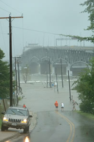 Storm surge is a dangerous wall of water created by the winds of severe storms like hurricanes, tropical storms, and nor’easters. These storms can cause Bay and ocean water to pile up before pushing it on shore. Storm surge is a dangerous wall of water created by the winds of severe storms like hurricanes, tropical storms, and nor’easters. These storms can cause Bay and ocean water to pile up before pushing it on shore.
Storm surge can affect large areas of coastal lands, but the amount of flooding is different with each storm. The surge height depends on the direction the storm approaches the coast, as well as the strength, speed and timing of the storm. If the storm hits land near the time of high tide, it would make the storm surge worse.
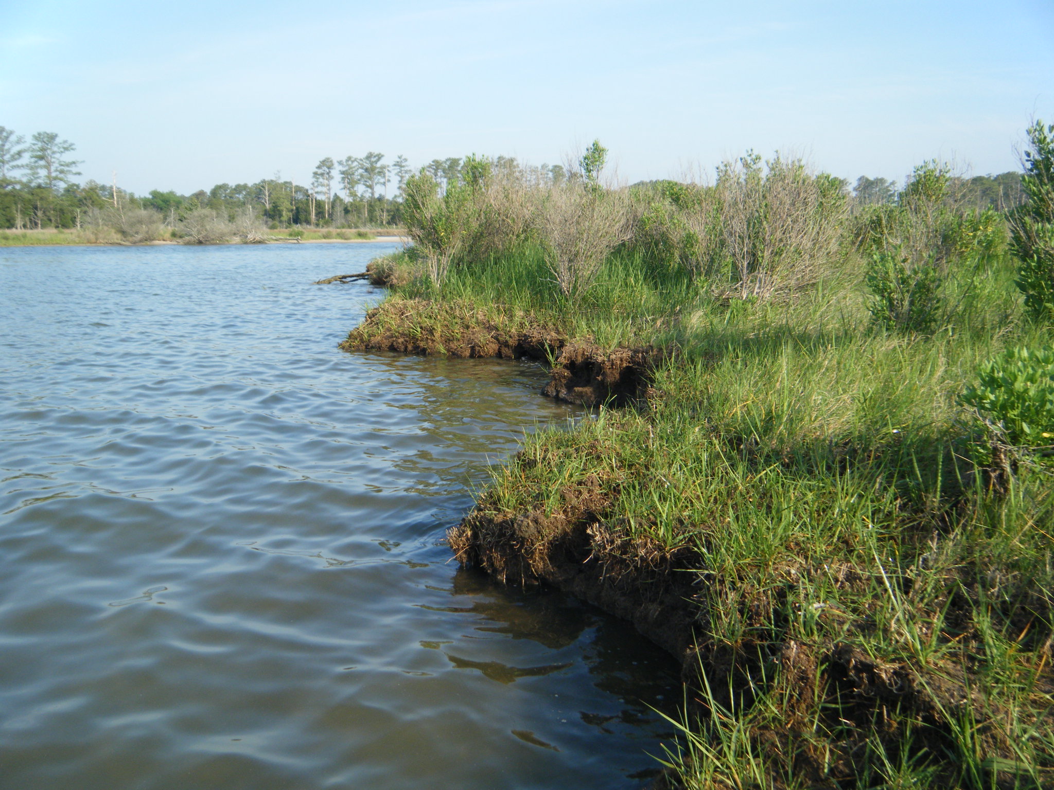
Along with powerful storm waves that hit the coastline for hours at a time, intense storm surges can cause major damage by knocking homes off their foundations, eroding marshes, breaking up dunes meant to protect coastal areas against storms, and flooding riverside communities.
|
Rainfall Flooding ...
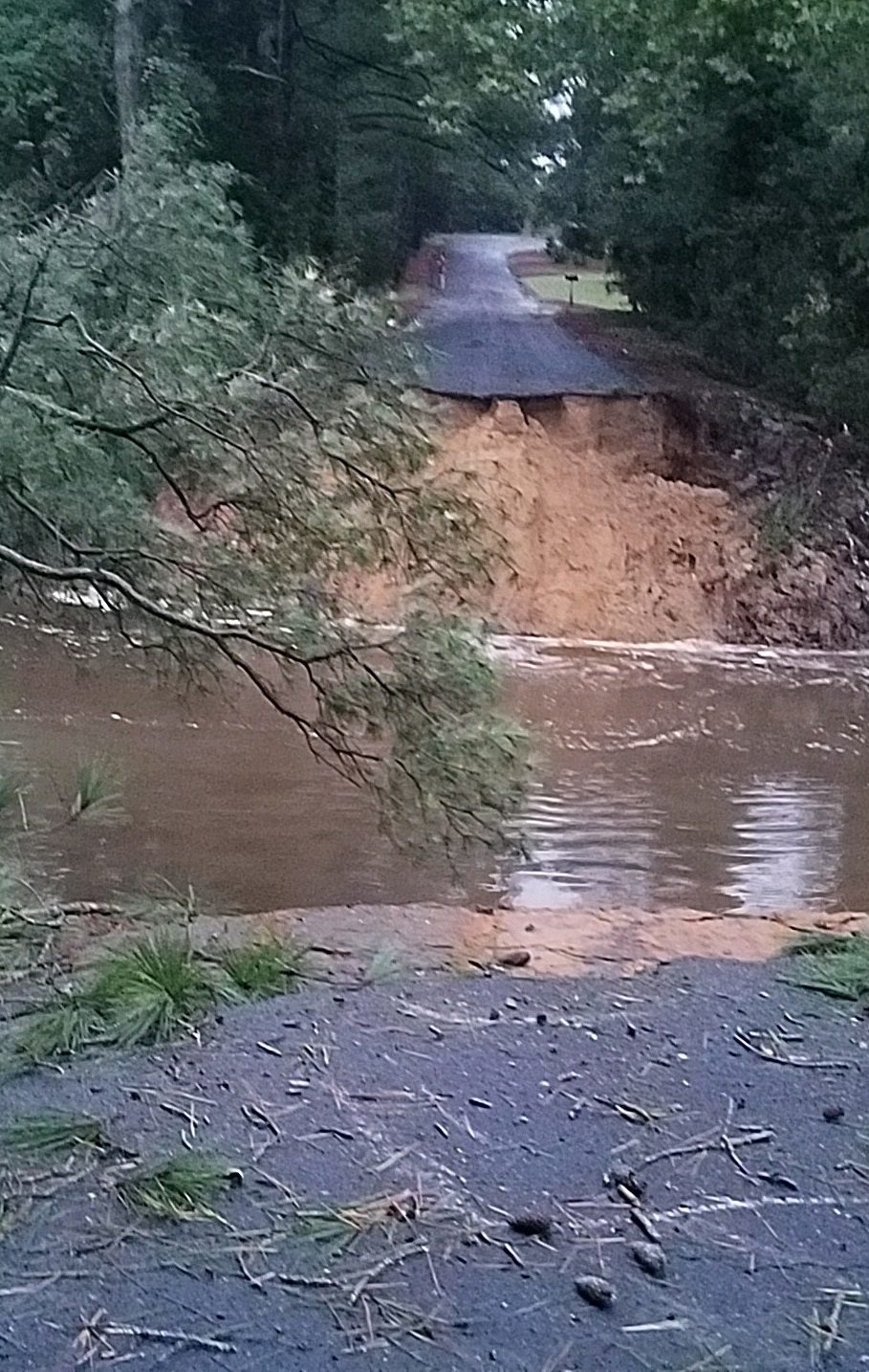 Rainfall flooding, or surface water flooding, is the flooding of land areas during and after heavy rain. Floods occur when the ground, storm sewers, ditches, streams, and rivers become overwhelmed causing the extra water to spread out across low-lying and downstream land areas. Rainfall flooding, or surface water flooding, is the flooding of land areas during and after heavy rain. Floods occur when the ground, storm sewers, ditches, streams, and rivers become overwhelmed causing the extra water to spread out across low-lying and downstream land areas.
In coastal Virginia, even a relatively small amount of rain can cause flooding in low-lying (low-elevation) areas. There are two main factors that can worsen rainfall flooding:
1) The area is covered by pavement and other manmade surfaces that lack the ability to absorb water. Rainfall flows off hard surfaces, which fills up water storage areas like ditches and storm sewers quickly.
2) The ground is already saturated or almost “full” of water. When an area has several rain storms in a short period of time or a very high ground-water table, any additional rainfall will stay above the ground.
|
Tidal Flooding ...
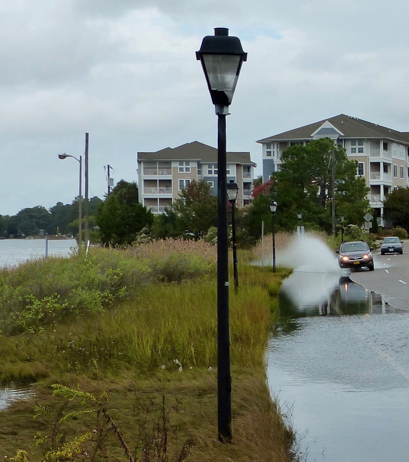
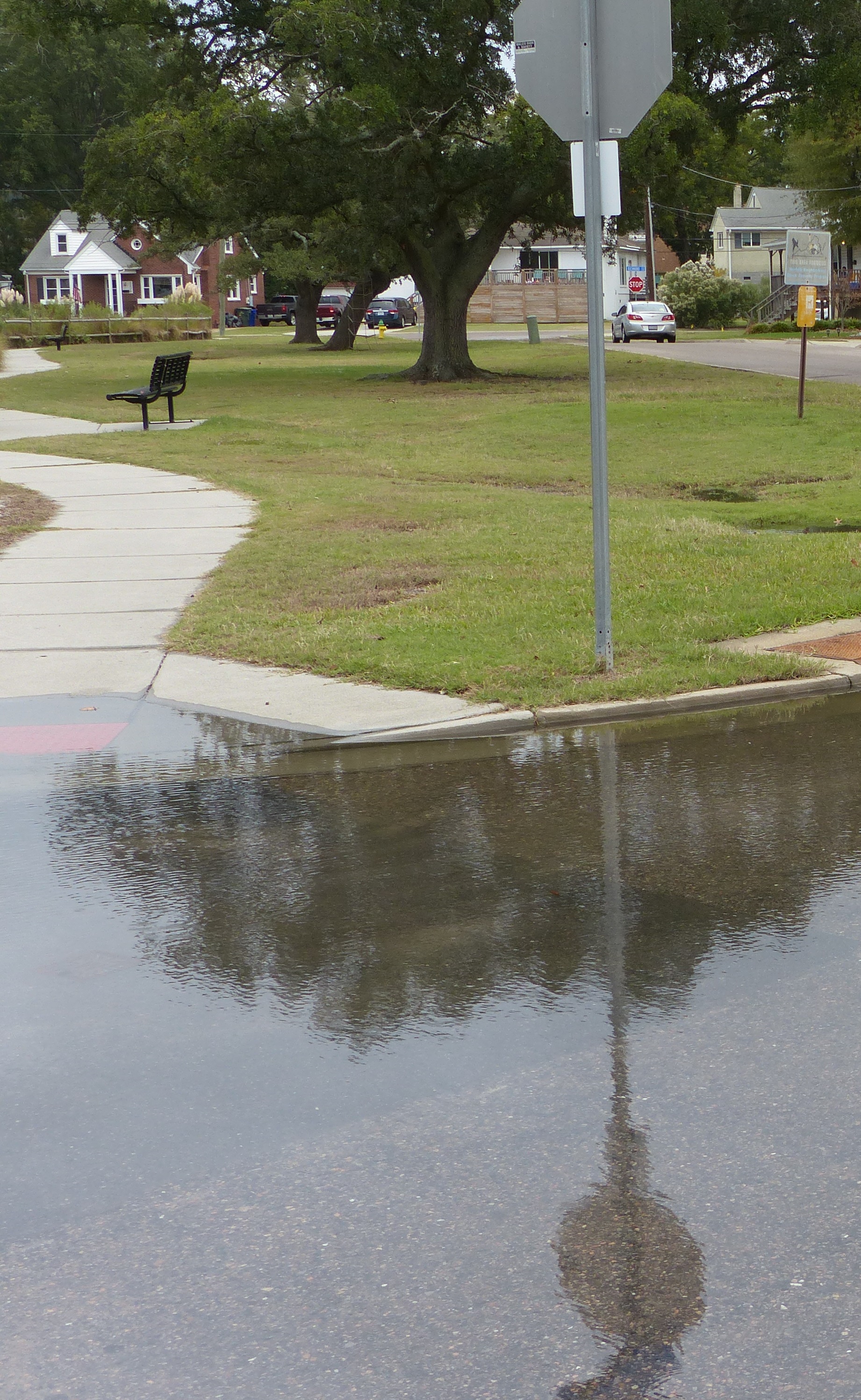 Tidal flooding is the temporary flooding of low-lying areas near the coast due to an exceptionally high tide. This kind of flooding, that typically results in less than a foot of water, is happening more often due to gradual sea level rise, land subsidence, and the loss of natural barriers. Tidal flooding is the temporary flooding of low-lying areas near the coast due to an exceptionally high tide. This kind of flooding, that typically results in less than a foot of water, is happening more often due to gradual sea level rise, land subsidence, and the loss of natural barriers.
Tidal flooding sometimes happens during full and new moon cycles every month and during annual King Tides, which are the highest tides each year. It is also called high tide or nuisance flooding when it disrupts daily life, or ‘blue sky’ and ‘sunny day’ flooding when it happens on without a storm event.
Frequent tidal flooding events can cause inconveniences such as mosquitoes, frequent road closures, overwhelmed storm drains, and structural damage leading to poor water quality, lower property values, and less tourism.
|
Combination Flooding ...
Often some combination of storm surge, rainfall, and tides will occur at the same time which can amplify the impacts of flooding and increase the uncertainties making it more difficult to successfully forecast.
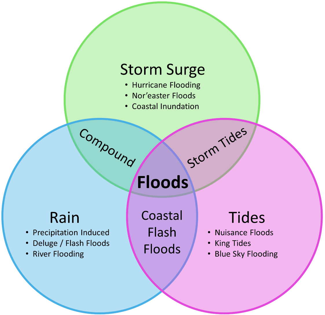
- A combination of storm surge and high tides is often referred to as storm tides.
- A combination of storm surge and rainfall is typically called compound flooding.
- Heavy rainfall during tidal flooding can rapidly lead to coastal flash floods.
|
Is flooding really a problem? Yes! Sea level and groundwater tables are rising, precipitation is becoming more intense, tidal flooding is more frequent and storm surge flooding happens more easily because of these higher water levels - all leading to more flooding events that often come at a personal and financial cost. Evidence of this can be seen in our neighborhoods with recurrent flooding, ghost forests, wetlands gradually appearing within developed areas and previously dry backyards, docks and piers going under water more often, community alerts and flood advisories.
"Impacts from flooding can range from temporary road closures to the loss of homes, property and life. In coastal Virginia, the cost of large storm damage can range from millions to hundreds of millions of dollars per storm." – Virginia Department of Emergency Management
Flood Facts ...
Virginia Flood Awareness Week encourages Virginians to learn about their flood risk and protect the life they’ve built with flood insurance.

- Floods are the most common and costly natural disaster in our country.
- 90 percent of all presidential declarations of emergency and major disasters involve flooding.
- On average, 100 Americans lose their lives in floods each year.
- On average, flood damages throughout the nation annually exceed $3 billion, and as of January 31, 2019, flood insurance claims in Virginia totaled more than $730 million.
- Both direct and indirect costs of flood recovery are borne by all American taxpayers, not just flood victims.
- Virginia has 2.3 million acres of mapped special flood hazard areas, which represents 9 percent of Virginia's land mass.
- Only 31 percent of people who live in a special flood hazard area have flood insurance.
- Floods can happen without warning and all Virginians should know their risk.
- Certain communities, including those of low economic means and communities of color, are disproportionally affected by flooding events.
|
What is the difference between flooding and sea-level rise?
Numerous weather and human-related factors influence whether or not a flood occurs. However, as the Intergovernmental Panel on Climate Change (IPCC) noted in its special report on extremes, it is increasingly clear that climate change “has detectably influenced” several of the water-related variables that contribute to floods, such as rainfall and snowmelt. So, while Earth’s changing climate may not induce floods directly, it exacerbates many of the factors that do by increasing precipitation and melting polar glaciers and sea ice, which results in sea level rise.
"Today, Virginia has 164,000 people at risk of coastal flooding. By 2050, an additional 137,000 people are projected to be at risk due to sea level rise." – Climate Central
- Find out why Hampton Roads is so vulnerable to Sea-level Rise. – VIMS "A Deeper Dive", YouTube video (0:41)
- Learn more about Sea-level Rise.
|
Find out more about flooding ...
- Learn more about Nuisance Flooding and why is it becoming a bigger issue in coastal Virginia. – VIMS "A Deeper Dive", YouTube video (0:40)
- Learn how VIMS is Forecasting Tidal Flooding by using tide gauge data and advanced computer models to generate accurate 36-hour predictions. – VIMS "A Deeper Dive", YouTube video (1:54)
- Watch how Modeling Storm Surge helps coastal communities be more resilient and improve their economic strength. – VIMS "A Deeper Dive", YouTube video (3:10)
- Learn about the AdaptVA web portal with tools and resources to help individuals and coastal communities think differently about how they live, work, and play along the coast. – VIMS Marine Science Day 2021, YouTube video (21:34)
- Read about Forecasting Coastal Water Levels in Virginia – Rivers & Coast, 2018 (pdf)
- Discover more about future flooding issues and adaptation strategies for reducing the impact of flood events in the Recurrent Flooding Study – Rivers & Coasts, 2012 (pdf)
- Watch this example of adapting to flooding - a shed built on a floating platform designed to rise during floods without releasing the contents stored inside. – YouTube video (:06)
- These adaptations were added in the Carl Hershner Teaching Marsh to help protect water quality and marsh habitat as well as improve access for learning.
|
|

 Storm surge is a dangerous wall of water created by the winds of severe storms like hurricanes, tropical storms, and nor’easters. These storms can cause Bay and ocean water to pile up before pushing it on shore.
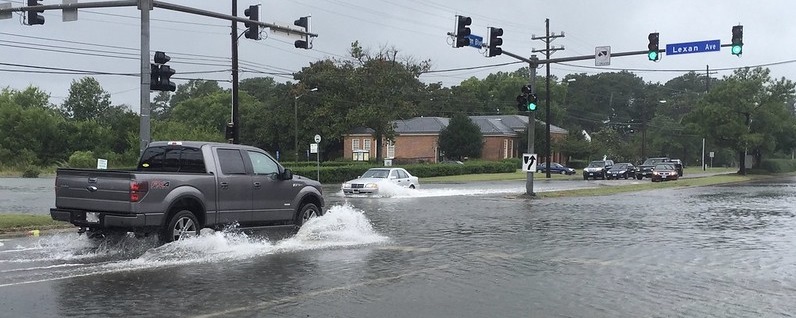
 Rainfall flooding, or surface water flooding, is the flooding of land areas during and after heavy rain. Floods occur when the ground, storm sewers, ditches, streams, and rivers become overwhelmed causing the extra water to spread out across low-lying and downstream land areas.
  Tidal flooding


